Floodlines Floodlines
Apr 3, 2009
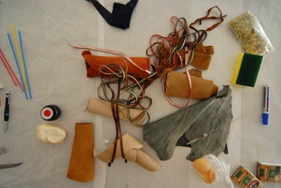
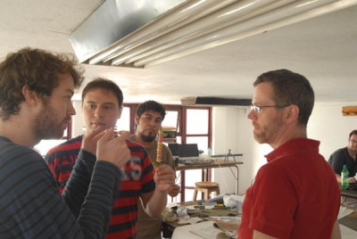
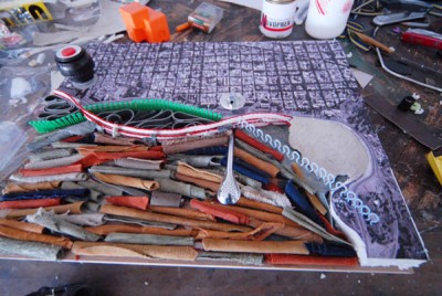
Modelmaking
Apr 3, 2009
Modelmaking
Apr 3, 2009
Modelmaking
Mar 31, 2009
- Marina van den Bergen
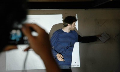
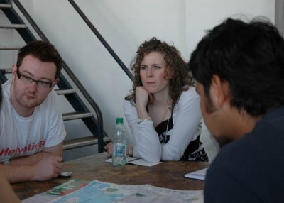
Workshop first presentations (update)
Group 6 will propose strategies that will take a long time before the outcome will be visible. It\'s about the flooded land and it\'s about social space. Both issues will be brought together.
The group looked at models showing what would happen if the sea-level rises with +5, +10 and +15 meters. What started as an issue concerning protection and connection, became more and more an issue about protection then connection. They work on making tools for interventions. For it they take something from the city and use that at the seaside, so that there always will be a connection between the city and the sea. One proposal concerns making a new zeppelin tower (in the town centre there is a building with a zeppelin landing platform).
Mar 30, 2009
- Marina van den Bergen
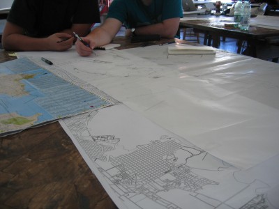
FLOODLINES
\'We must think models\'
\'What if the water takes this and this piece of land\'
\'We need shadow\'
\'Use the fishers as an inspiration\'
\'...concentrate on a bigger scale. If all plots floods, what are the high points, we can connect them\'
\'We agreed that this is a nice shape of the new coastline\'
\'This is more Dubai!\'
\'We must get rid of some streets and make canals\'
Mar 26, 2009
start workshop
Mar 26, 2009
Mar 25, 2009
The brief: Floodlines
Greenhouse gas CO2 emissions and polar ice melt will generate massive catastrophes all over the world in the near future. This century, Montevideo might be hit by an enormous tsunami, where portions of the city will be submerged. Infrastructure, public and residential buildings will be destroyed and their contents lost. What should we do as architects, recreate the lost programmes or reinvent new typologies, which will cope with future catastrophes? Would new programmes emerge from the analysis of such phenomena?
This workshop aims to explore the impact of sea level change, storm surges and their impact from a fictional event on Montevideo. The events of New Orleans and Indonesia will be used as reference case studies in order to map a possible event. This catastrophic effect will create a new coastline to Montevideo submerging existing programmes and infrastructures. The coast, the harbour, the docks, the beach, the seafront promenade will all now take on a new edge condition.
In this light, should we, as architects, merely recreate what was lost or create new typologies for the city? Should we create new architectural solutions to cope with future phenomena?
Some of the participants will look at FLOOD from an urban design scale and some will investigate individual architectures on the floodline. Clearly defined propositions should emerge from such studies with an emphasis on mapping techniques for the final presentation.
Mapping References
Kovats, Tania, The Drawing Book, BlackDog Publishing, 2005 ISBN 190772331
Withfield, Peter, London: A life in Maps, British Library, 2006. ISBN978 0 7123 4918 5 (HB)
The Agile Rabbit Book of Historical and Curious Maps, Pepin Press, Holland, 2005. ISBN 9057680513
Harmon, Katherine, You are here, Personal Geographies and Other Maps of Imagination, Princeton, NYC, 2004. ISBN 1 56898 430 8
Tufte, Edward, Visual Explanations, Graphic P., Connecticut, 1997. ISBN 0961392126.
Tufte, Edward, Envisioning Information, Graphic P., Connecticut,1990. ISBN0961392118
Tufte, Edward, Beautiful Evidence, Graphic Press, Connecticut, 2006. ISBN 0961392177
Lockwood, Arthur, Diagrams, A Visual Survey of Graphs, Maps & Charts, Studio Vista, London, 1969. ISBN 289 370302
Owen, William, Mappings, An illustrated Guide Tographical Navigational Systems, Rotovision, Switzerland, 2005. ISBN 288046 824 8
Mar 25, 2009
Participants group 2
PARTICIPANTS:
> Francisco G. B. Abreu
> Adrian Aviles Montaño
> Catherine Blum
> Eilidh Henderson
> Andrew McEwan
> Matthew Murphy